Startpagina / Ontdek de app /

Breakfast Brief: Storms shift south, the cool spreads

Breakfast Brief
Storms shift south, the cool spreads

A marked cool-down will be felt across the Eastern Seaboard while the responsible cold front continues to march south, bringing more storms to the Deep South and Mid-South U.S. The West stays hot and stormy.

Temperatures plummeted across the Eastern Seaboard yesterday evening after a storm-producing front arrived from the west. Many locations, including the large I-95 metros, saw temperature drops of up to 20 degrees from the afternoon to early evening. While another warm day is forecast today, these relatively cooler temperatures will stick around through the weekend.

Did you know?

On this day in 1996, a powerful F5 tornado struck Oakfield, Wisconsin, causing extensive damage. This tornado, part of a significant severe weather event, demolished homes and businesses and injured numerous people.

A national overview of the prevailing weather across the Continental U.S.

The same front that brought a refreshing cooldown to the north is making its way across the Deep South today. From east Texas to the Carolinas, expect showers and thunderstorms, with some storms producing heavy rain and isolated flash flooding.

In the West, the main story is isolated showers and thunderstorms in the Rockies and Four Corners region, with potential flash flooding in areas of heavy rain. Meanwhile, the Intermountain West, San Joaquin Valley, and Desert Southwest will remain predominantly dry with slightly rising temperatures through the weekend.

Tropical update:

Currently, no development is expected over the next seven days.

The news we're covering today:

  • Twisters, the movie, premieres this week, and we're kickstarting an article series to introduce you to everything you need to get you ready for the film. We published the first article of the week on Tuesday. Check it out below.

Did you miss these?

Do you know how tornadoes form?Twisters the movie
What are Derechos?lees meer

App news & updates

When heat builds and a front nears, the natural response of the atmosphere is to produce storms. Under the right conditions, these storms can become strong or even damaging. Always stay storm-aware with our automated alert system. Here's how you can turn them on!

Nu de app downloaden
Meer app-functies
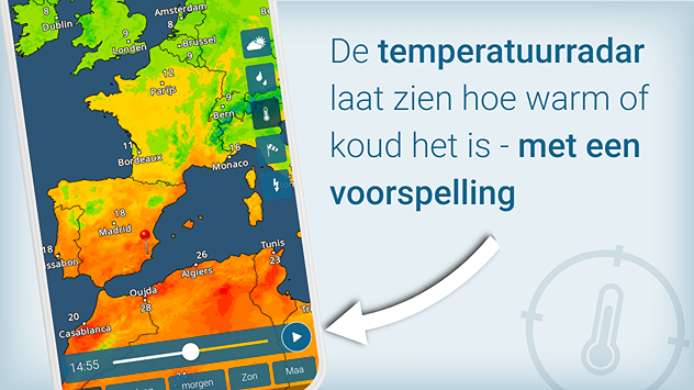
Een kaart van de temperatuurradar van de Weer & Radar app. De temperatuurradar laat zien hoe warm of koud het is en heeft ook een voorspellingsfunctie voor de komende uren.

Warm of koud?

Met de TemperatuurRadar door het jaar
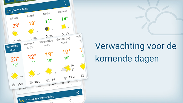
Een overzicht van de weersverwachting voor de komende dagen van de Weer & radar app. Met deze functie heb je een handig overzicht over de weersontwikkelingen voor de middellange termijn.

Zo gaat het verder

Het weer in de komende dagen

Doe mee!

We willen jouw weer- en natuurfoto's!
Alle functies van de app
Weer & Radar

www.weerenradar.be

facebooktwittertikTokContact
Privacy Policy | Colofon | Toegankelijkheidsverklaring